


iGISc 2026 Call for Papers 4th International Conference on Geographical Information Science iGISc 2026
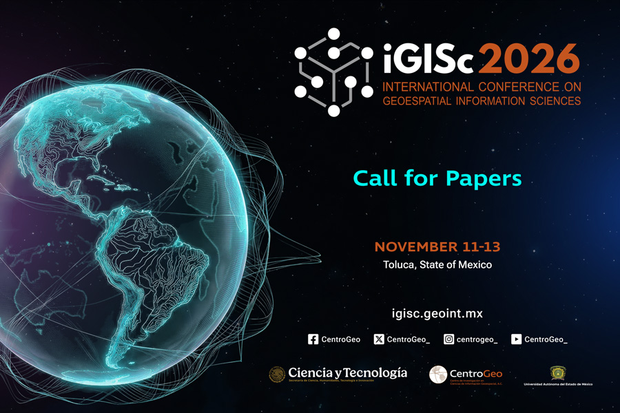
Call for Papers
4th International Conference on Geographical Information Science iGISc 2026
The Research Center in Geospatial Information Sciences (Centro de Investigación en Ciencias de Información Geoespacial, CentroGeo), a part of Mexico's National Ministry of Science, Humanities, Technology, and Innovation (Secretaría de Ciencia, Humanidades, Tecnología e Innovación, SECIHTI), invites researchers, practitioners, and professionals from academia, government, industry, and civil society to submit original contributions to the 4th International Conference on Geographical Information Science 2026 (iGISc 2026). The conference will be held at the Universidad Autónoma del Estado de México from 11 to 13 November 2026.
The iGISc 2026 conference provides an international forum for the exchange of scientifi c knowledge, methodological advances, and technological developments in Geographical Information Science (GIScience). The conference aims to strengthen interdisciplinary dialogue and promote the integration of basic and frontier research with applied approaches to address complex territorial challenges of high social, environmental, and economic relevance. The event brings together researchers and practitioners working at the intersection of spatial analysis, geospatial technologies, and societal applications.
Call for Submissions
The conference welcomes submissions of original, unpublished research in the form of extended abstracts (max. 1000 words). All submissions must clearly demonstrate scientifi c relevance, methodological rigor, and potential impact.
At the time of submission, authors must choose one of two tracks:
Publication Track: Select this option if your goal is to be considered for a book chapter. If your abstract is accepted, it will be published in the conference proceedings. Based on the evaluation, the Scientifi c Committee may then invite selected authors to submit a full manuscript for inclusion in an edited book.
Poster Track: Select this option if you prefer to present your work as a poster. Accepted posters will be displayed during dedicated sessions, and their extended abstracts will also be published in the conference proceedings.
Note on AI Use: Authors must disclose any use of artifi cial intelligence tools beyond grammar/spelling correction or translation. This disclosure must be included in the extended abstract.
Conference Tracks
Track 1 – Geographic Information Systems, Cartography and Geoinformatics
Focuses on contributions addressing the development, evolution, and application of Geographic Information Systems, cartography and geoinformatics as scientifi c and technological disciplines. This track welcomes research exploring conceptual, methodological, and computational advances, as well as innovative applications of GIS for spatial representation, analysis, and territorial management.
Example topics within this track include, but are not limited to:
● Theoretical foundations of GIScience and spatial thinking
● Spatial data models and geographic representations
● Advanced spatial analysis and geographic modeling
● Cartographic design, visualization, and geovisual analytics
● Multi-scale and multi-resolution spatial analysis
● Integration of heterogeneous and big geospatial data
● Spatial decision support systems
● GIS applications in planning, public policy, and territorial management
Track 2 – Remote Sensing, Photogrammetry, and Geodesy
Brings together research focused on the acquisition, processing, and analysis of geospatial data derived from remote sensing platforms, photogrammetric techniques, and geodetic methods. Contributions may present theoretical and methodological advances, as well as the development and application of emerging and innovative technologies.
Example topics within this track include, but are not limited to:
● Satellite, airborne, UAV, and terrestrial remote sensing
● Photogrammetric methods and three-dimensional reconstruction
● Geodetic reference systems and positioning techniques
● Image processing, classifi cation, and feature extraction
● Multi-sensor data fusion and integration
● Multi-temporal analysis and change detection
● Environmental, urban, and agricultural monitoring
● Risk, hazard, and disaster assessment
● Earth observation for climate and global change studies
Track 3 – Geographical Information Science and Society
Emphasizes the role of GIScience as a bridge between scientifi c research and the understanding and management of complex territorial problems with signifi cant social impact. This track welcomes contributions that integrate scientifi c, technological, and
social perspectives to support inclusive, interdisciplinary, and evidence-based approaches to territorial analysis.
Example topics within this track include, but are not limited to:
● GIScience applications for public policy and territorial governance
● Spatial justice, equity, and inclusion
● Participatory GIS and citizen science
● Sustainable development and territorial planning
● Risk reduction, vulnerability, and resilience
● Environmental, urban, rural, and regional spatial analysis
● Indigenous and local spatial knowledge
● Ethical, legal, and social implications of geospatial technologies
Track 4 – Artifi cial Intelligence and Geographical Information Science
This track is dedicated to the exploration and application of Artifi cial Intelligence techniques in GIScience. Contributions may address theoretical, methodological, or technological developments that enhance the analysis, modeling, and prediction of geospatial phenomena.
Example topics within this track include, but are not limited to:
● Machine learning and deep learning for geospatial data
● AI-based spatial prediction and modeling
● Integration of AI methods with GIS platforms
● Automated feature extraction and classifi cation
● Artifi cial Intelligence for remote sensing image analysis
● Spatiotemporal data mining
● Explainable and interpretable AI in geospatial applications
● Ethical and responsible use of AI in GIScience
Submission and Publication Process
1. All accepted extended abstracts will be published in the conference proceedings.
2. Authors who submitted to the Publication Track may be invited, based on the Scientifi c Committee's evaluation, to submit a full manuscript for consideration as a book chapter. These manuscripts will undergo a further review process.
Important Dates
Call for Papers opens: March 2026
Extended abstract submission deadline: June 2026
Notifi cation of acceptance and format assignment: August 2026
Full manuscript submission (for selected contributions): September 2026
Conference dates: 11-13 November, 2026
November 11-13, 2026 Toluca, State of Mexico
Secretaría de Ciencia, Humanidades, Tecnología e Innovación (SECIHTI)
Centro de Investigación en Ciencias de Información Geoespacial (CentroGeo)
Universidad Autónoma del Estado de México (UAEM)
Enlace directo aquí
Más Vistos
- iGISc 2026 Call for Papers 4th International Conference on Geographical...
- Día de la Geociencia abierta del CentroGeo
- Coloquio la IA Generativa en el quehacer científico
- ConectAgro Tibaitatá inicia su temporada 2026 con el evento: Hablemos de...
- Presentación del primer Doctorado Nacional en Agroecología en México
Más Recientes
- Editoriales hegemónicas: El conocimiento científico bajo llave y cómo romper...
- iGISc 2026 Call for Papers 4th International Conference on Geographical...
- ConectAgro Tibaitatá inicia su temporada 2026 con el evento: Hablemos de...
- Día de la Geociencia abierta del CentroGeo
- Coloquio la IA Generativa en el quehacer científico
Nosotros
Las opiniones y datos contenidos en este sitio son de la exclusiva responsabilidad de su(s) autor(es) y no representan el punto de vista de la institución.
Accesos Directos
Contáctanos
Fraccionamiento Tecnopolo Pocitos
Aguascalientes, Aguascalientes, México.
(4499) 94-54-50
Laboratorio Nacional de Geointeligencia
Lomas de Padierna, Tlalpan
Ciudad de México, México.
(5526) 15-25-08
Laboratorio Nacional de Geointeligencia
Parque Científico Tecnológico Yucatán
Mérida, Yucatán, México.
(9996) 88-53-00 y 42, (9994) 06-00-22 y 25
Ver más...
2026 © Todos los derechos reservados Laboratorio Nacional de Geointeligencia GeoInt.
Política de privacidad | Términos de servicio